Greater Victoria's Shorelines, One by One
No two stretches of waterfront here behave the same way. Exposure to wind and swell, the shape of the shore, the view and the access to the water all change from one bay to the next. These are the shorelines where waterfront land comes up.
The Strait of Juan de Fuca
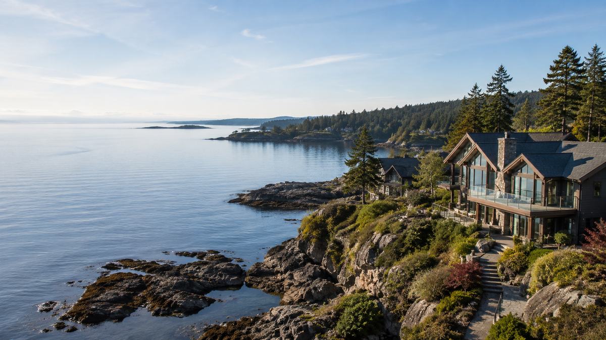
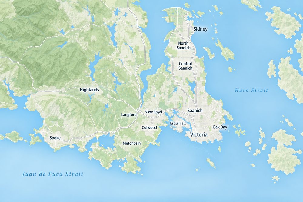
The Strait of Juan de Fuca runs about 154 kilometres from the Pacific to Haro Strait, with the Olympic Peninsula of Washington State forming its southern shore. Land facing the strait, from Colwood and Metchosin west through East Sooke and along the West Coast Road toward Jordan River, gets big southern views, long sunsets and the full force of winter storms. Expect rocky shore, bluffs and pocket beaches, and plan the house for wind and salt spray.
The Sooke Basin and Sooke Harbour
The Sooke Basin is a sheltered body of salt water of about 10 square kilometres, joined to the strait through Sooke Harbour, a narrow natural harbour about 4 kilometres long. Its northern half lies in the District of Sooke and its southern half in East Sooke, part of the Juan de Fuca Electoral Area. The shores are mostly rock, with sandy beaches along parts of the north shore. Anderson Cove has the basin's only public boat launch, and Roche Cove Regional Park sits at its eastern end, so calm-water boating is close at hand.
Esquimalt Lagoon and the Colwood Waterfront
Esquimalt Lagoon in Colwood is a shallow lagoon separated from the open ocean by a sand spit, and it is one of seven federal Migratory Bird Sanctuaries in British Columbia. The Colwood waterfront looks toward Victoria at one end and the Olympic Mountains at the other, with Fisgard Lighthouse in view. Land along this shore is rare and comes with the extra care that a protected bird habitat brings.
Haro Strait and the East Shore
Haro Strait separates Vancouver Island from the San Juan Islands of Washington State and is one of the main channels between the Strait of Georgia and the Strait of Juan de Fuca. East-facing shore in Oak Bay, Ten Mile Point, Cordova Bay and along the Saanich Peninsula looks across it to the islands, with morning sun and passing ships. It is also a well-known whale-watching area, and Discovery Island lies just offshore from Oak Bay.
Saanich Inlet
Saanich Inlet is a fjord about 25 kilometres long and up to 226 metres deep, running between the Saanich Peninsula and the Malahat. Its eastern shore takes in Brentwood Bay and Deep Cove, while Finlayson Arm reaches south toward Goldstream. West-facing land here catches the afternoon and evening sun over the Malahat, and the inlet is generally calmer than the open strait.
The Gorge Waterway and Portage Inlet
The Gorge Waterway is the tidal channel linking Victoria Harbour with Portage Inlet, bordered by Victoria, Esquimalt, Saanich and View Royal. Waterfront land here is in the city rather than the country, with kayaking and paddleboarding from the back garden. Gorge Park, which opened in 1905, lines part of the Esquimalt shore. Lots are small and rare, and the rules on building near the water are strict.
Types of Waterfront and What They Mean
The word waterfront covers very different land. Before you compare prices, sort each listing by the kind of frontage it has:
- Walk-on or low bank. Easy access to the beach and the water, and the most sought after. It is also the most exposed to storm surge and sea level rise.
- High bank or bluff. Big views and more protection from the sea, but access to the water may need stairs, and the stability of the bank must be checked.
- Rocky shore. Common across the region. Often dramatic and stable, but access to the water can be limited.
- Lake, river or waterway. Freshwater or sheltered tidal frontage, generally calmer, with its own riparian rules.
The Foreshore, Docks and Moorage
In British Columbia, the province owns nearly all of the foreshore, both salt water and fresh water. A private owner owns the upland, and the public keeps the right to use the foreshore in front of it. That has two consequences every waterfront buyer should understand.
First, a dock is not automatic. Building or using a private dock on Crown land needs provincial authorization, either by meeting the terms of the General Permission or through a Specific Permission or a lease. The General Permission is not available in designated Application-Only Areas. Only one dock per property is allowed, docks must not block public access along the foreshore, and fill below the natural boundary and dredging are not permitted. The dock must also comply with local zoning, and a mooring buoy needs separate federal approval through Transport Canada.
Second, an existing dock is only as good as its authorization. If a listing shows one, ask for the paperwork, and check that it meets current rules before you count on it.
Never Assume a Dock
A waterfront lot without a dock is not a waterfront lot with a dock waiting to be built. Confirm with the province and the municipality that a dock is possible at that spot before you pay for one in the price.
Living With the Public Foreshore
Because the foreshore is public, people may walk the beach in front of a waterfront home, and owners cannot fence or build below the natural boundary. Erosion protection or a seawall that extends onto the foreshore needs provincial authorization as well as local permits, and soft approaches such as planting and drainage control are often preferred. Buyers who value privacy usually look for high-bank or rocky frontage, or for a building site set well back behind trees.
Building a Home on the Water
A waterfront home has to be designed for its exposure. On the open strait, wind, rain and salt spray call for tough cladding, sealed windows and corrosion-resistant fittings. On a bluff, the house usually sits back from the edge, with drainage carried away from the bank rather than over it, and a geotechnical engineer will set the safe distance. On a low lot, the main floor may need to sit above a flood construction level.
Think about sun as well as view. On the Sooke Basin, for example, the north shore faces south across the water, while the south shore in East Sooke looks north. A lot that faces the view but not the sun can feel very different in winter, so visit at different times of day before you decide.
Setbacks, Riparian Areas and Coastal Rules
Many municipalities set special rules for building near the sea, usually through shoreline development permit areas that control setbacks, vegetation and erosion protection. Along streams and lakes, the Riparian Areas Protection Regulation applies across the Capital Regional District and sets a 30-metre assessment area on each side of a stream, where development needs a professional assessment. On some lots these rules decide where the house can sit, so check them before you design.
Sea Level Rise and Coastal Flooding
The Capital Regional District's coastal flood inundation mapping project modelled coastal flooding from sea level rise and tsunamis for southern Vancouver Island and the Southern Gulf Islands, to help local governments plan for coastal storms. For a low-lying lot, ask the municipality what flood construction level applies, how high the main floor must be, and whether any covenants on title deal with flooding. High-bank and rocky sites are less exposed, but their stability deserves a geotechnical look.
Water, Septic and Heritage on the Shore
Many waterfront parcels outside the urban core rely on a well and an onsite septic system. A septic field has to be set back from the water, which can be tight on a narrow shoreline lot, so have an Authorized Person assess the site before you buy, and test any well for both yield and water quality.
Shorelines were also home to many First Nations villages and camps over thousands of years. Archaeological sites in BC are protected under the Heritage Conservation Act whether or not they have been recorded, and altering one requires permits, so a search through the provincial Archaeology Branch is worth requesting for any waterfront parcel.
What Sets the Price of Waterfront Land
With so few sales, waterfront land is valued parcel by parcel. The usual drivers are the type and length of frontage, the view and the direction it faces, protection from winter storms, privacy, the ease of getting to the water, and whether a dock is possible. A sheltered, south-facing lot with a gentle walk to the water usually commands the most, while a steep, exposed or hard-to-reach shore trades for less. The market report shows recent sales, but expect to compare across several shorelines.
Waterfront Land at a Glance
| Shoreline | Character | Faces | Watch for |
|---|
| Strait of Juan de Fuca | Open, rocky, dramatic | South, to the Olympic Peninsula | Winter storms, wind, salt spray |
| Sooke Basin | Sheltered salt water, rock and some beach | Varies around the basin | Municipality or electoral area rules |
| Esquimalt Lagoon | Lagoon and sand spit | South and east | Migratory Bird Sanctuary, low elevation |
| Haro Strait | Rocky points and coves | East, to the San Juan Islands | Exposure, shoreline permits |
| Saanich Inlet | Calm fjord water | West, to the Malahat | Steep shore in places, septic setbacks |
| Gorge Waterway | Urban tidal channel | Varies | Small lots, strict setbacks |
Waterfront Lots or a Waterfront Home?
Because vacant waterfront is so scarce, many buyers widen the search to homes. Compare these lots with waterfront acreages, or with waterfront homes in Sooke, Metchosin, North Saanich and across the Saanich Peninsula. An older home on a waterfront lot is often a land purchase in all but name, and existing improvements near the water can be hard to replicate under today's rules.
Waterfront Land Pages by Area
Waterfront Land: Common Questions
Who owns the beach in front of a waterfront lot?
In most cases the province owns the foreshore, and the public keeps the right to use it. The owner holds the upland, so a waterfront lot gives you access to the water rather than private ownership of the beach.
Can I build a dock on a waterfront lot?
Only with provincial authorization, either under the General Permission or through a Specific Permission or a lease, and only if local zoning allows it. Some areas are application-only, so confirm before you buy.
Does waterfront on the MLS always mean oceanfront?
No. The waterfront field can include lake, river and waterway frontage as well as ocean. Check the type of frontage on each listing.
Does it cost more to build on waterfront land?
Often, yes. Shoreline permits, geotechnical work on banks and bluffs, septic setbacks from the water and materials that stand up to salt and wind all add cost, so budget for them alongside the price of the land.