Living in Esquimalt, BC: Waterfront, History & Local Real Estate
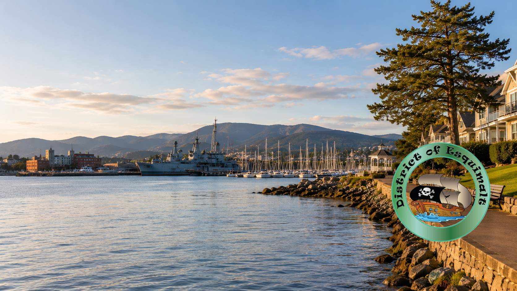
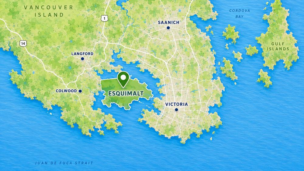
Esquimalt is one of Greater Victoria’s most historic and practical coastal communities, located directly beside Victoria and minutes from downtown, the Inner Harbour, CFB Esquimalt, West Bay, Saxe Point, the Gorge Waterway, and the Songhees waterfront. Buyers are often drawn to Esquimalt for its central location, oceanfront parks, naval history, established residential streets, and comparatively attainable real estate options close to the core.
Esquimalt has not always had the same reputation as some of Victoria’s older prestige neighbourhoods. For many years, some local buyers overlooked the area because of its working harbour, industrial activity, naval base, older housing stock, and more practical blue-collar identity. That perception has changed significantly as buyers have become more aware of Esquimalt’s location, waterfront access, parks, improving housing stock, and convenience compared with more remote Greater Victoria suburbs.
Today, Esquimalt offers a mix of character homes, condos, townhomes, half-duplexes, waterfront properties, view homes, and newer infill housing. Its combination of history, harbour access, walkability, recreation, and proximity to downtown Victoria makes it one of the more interesting local markets in Greater Victoria.
Esquimalt real estate includes a broad mix of condos, townhomes, character houses, newer homes, revenue properties, waterfront homes, view properties, lots and land, and detached houses on established lots. The municipality is relatively compact, but the housing market is varied. One street may feel like an older Victoria residential neighbourhood, while another may be closer to the harbour, the Dockyard, West Bay, Saxe Point, or the Gorge Waterway.
Buyers comparing Esquimalt homes should pay close attention to location within the municipality. Saxe Point and West Bay can feel quite different from Esquimalt Town Centre, Rockheights, Parklands, Gorge Vale, Craigflower, or areas close to CFB Esquimalt. Some buyers focus on walkability and waterfront parks, while others prioritize suite potential, lot size, strata rules, parking, transit, building age, or commute time.
Compared with some of Victoria’s more expensive core neighbourhoods, Esquimalt can offer strong lifestyle value. That does not mean every property is inexpensive. Waterfront homes, renovated character homes, newer houses with suites, and well-located condos can still command strong prices. The key is understanding the micro-location, building condition, strata profile, view potential, and proximity to amenities.
Popular Esquimalt Neighbourhoods and Local Areas
Esquimalt is small, but it is not one uniform market. The best area depends on what a buyer values most: waterfront access, parks, commute time, walkability, schools, strata options, detached homes, character streets, or proximity to the Dockyard and downtown Victoria.
Saxe Point
Saxe Point is one of Esquimalt’s best-known residential areas, valued for Saxe Point Park, shoreline access, quiet streets, ocean outlooks, and established homes. Buyers looking for a more park-like coastal setting often pay close attention to this part of Esquimalt. Depending on the listing mix, buyers may compare Esquimalt houses, waterfront homes, and view homes in or near this area.
West Bay
West Bay offers marina access, harbour atmosphere, walkability, and proximity to the Songhees waterfront and downtown Victoria. The area includes condos, townhomes, and residential streets close to the water, with some properties offering harbour or marina outlooks.
Esquimalt Town Centre
The Town Centre area is practical for buyers wanting shops, services, transit, recreation, and local amenities nearby. It includes condos, older homes, redevelopment potential, and convenient access to Esquimalt Road, Admirals Road, the Dockyard, and downtown Victoria. Buyers looking for convenience may compare Esquimalt condos, Esquimalt townhomes, and pet-friendly condos near the centre.
Rockheights and Parklands
Rockheights and Parklands offer elevated residential pockets, established homes, mature trees, and access to parks and schools. Some properties may offer outlooks, larger lots, or a quieter residential feel while remaining close to the city core.
Gorge Vale and Craigflower
The Gorge Vale and Craigflower areas connect Esquimalt with the Gorge Waterway and nearby Victoria neighbourhoods. Buyers may find condos, townhomes, older homes, and properties with convenient access to parks, transit, the Gorge, and major routes.
Areas Near CFB Esquimalt
Homes near CFB Esquimalt and the Dockyard can be especially practical for military, DND, and civilian workers who want a short commute. Buyers should consider traffic patterns, parking, building age, and proximity to amenities when comparing these locations.
Parks, Waterfront, and Recreation in Esquimalt
One of Esquimalt’s strongest advantages is access to the water. Saxe Point Park, Macaulay Point Park, West Bay, the Gorge Waterway, local beaches, harbour viewpoints, and waterfront walking routes give the area a coastal lifestyle that is not always obvious to buyers who only know Esquimalt by its naval and industrial history.
Recreation is also a major part of local life. Esquimalt Recreation Centre, parks, playing fields, schools, shoreline paths, and nearby marinas make the municipality practical for families, active buyers, downsizers, and people who want to be close to Victoria without giving up green space or water access.
Commuting and Location
Esquimalt’s location is one of its clearest strengths. The municipality is directly beside Victoria, with quick access to Vic West, the Inner Harbour, downtown employment, James Bay, Tillicum, View Royal, and the Westshore. Depending on the property location, many residents can reach downtown Victoria, the Dockyard, West Bay, or the Songhees area quickly by car, bike, transit, or on foot.
Buyers should still consider local traffic patterns, parking, transit routes, and bridge access. A home close to West Bay may feel different from a home near Admirals Road, Craigflower, or the Dockyard. Like many central Greater Victoria locations, the micro-location matters.
Esquimalt History: A Place of Shoaling Waters
Esquimalt has a rich history, and an aura of things old, romantic, and adventurous still clings to the area. Its streets bear the names of great admirals and ships of the past. Esquimalt was a naval base in the days of sail, and it became the only base of the Royal Navy in the North Pacific. Don Manuel Quimper, a lieutenant in the Spanish Navy, explored Esquimalt Harbour. James Douglas, Chief Factor of the Hudson’s Bay Company, later explored the area and recorded its Indigenous name.
The name Esquimalt is commonly traced to an Indigenous word often interpreted as “place of gradually shoaling waters” or “a place of shoaling waters.” The earlier form, often written as Is-whoy-malth, referred to the flats at the head of the harbour near the mouth of Mill Stream. The name described an important feature of the harbour and the place where fresh water could be found.
The story of Esquimalt after European contact is filled with the romance of sea and land. It does not begin with Captain Cook or Vancouver, but with Spanish explorers, followed later by the pioneers of the Hudson’s Bay Company. The early Spanish visitors to the harbour included Don Manuel Quimper, who sailed the Princess Real into Esquimalt Harbour in 1790 and made a rough chart of the harbour, which he named Puerto de Cordova.
In the years that followed, Spanish expeditions continued to explore and chart the Strait of Juan de Fuca and nearby waters. Francisco de Eliza, Jose Maria Narvaez, Dionisio Galiano, and Cayetano Valdes are among the names connected with early exploration of the coast. Although few Spanish relics remain, their place names and surveys formed part of the early European record of the region.
James Douglas later examined Esquimalt Harbour while searching for a suitable site for a Hudson’s Bay Company post. He recognized Esquimalt as one of the best harbours on the coast, though he ultimately preferred the agricultural land around Camosack, where Fort Victoria would be established. The decision helped shape the future relationship between Victoria and Esquimalt: Victoria became the commercial and administrative centre, while Esquimalt developed around its harbour and naval role.
The Royal Navy and later Canadian naval operations became central to Esquimalt’s identity. H.M.S. Constance was the first naval ship to make Esquimalt Harbour her base. Other naval vessels, officers, surveyors, and engineers followed, leaving their names on local places, coves, roads, and landmarks. Esquimalt Harbour became closely associated with naval defence, ship repair, graving dock activity, and the wider history of British and Canadian presence on the Pacific coast.
The Crimean War helped push Esquimalt further into naval importance. The need for a hospital and shore establishment led to early naval facilities on Duntze Head, and later development around the harbour continued to shape the municipality. CFB Esquimalt remains one of the defining institutions in the area today, influencing local employment, housing demand, and the character of the community.
This history is one reason Esquimalt feels different from many other Greater Victoria neighbourhoods. It has a working harbour background, naval heritage, older residential streets, waterfront parks, and a practical local identity. What was once overlooked by some buyers is now increasingly recognized as one of the most convenient and historically interesting places to live close to downtown Victoria.
Who Esquimalt Works Best For
Esquimalt can work well for many different types of buyers. First-time buyers may consider Esquimalt because it can offer more attainable options than some nearby Victoria neighbourhoods. Military, DND, and civilian workers connected to CFB Esquimalt may value the short commute. Downsizers may focus on condos and townhomes near shops, parks, transit, or the waterfront. Investors may look for rental demand, suite potential, and proximity to major employment areas.
Buyers who want a central location without the same price profile as Oak Bay, Fairfield, James Bay, or parts of Saanich may also compare Esquimalt carefully. The area is especially worth considering for people who want parks, shoreline access, established streets, walkability, and quick access to Victoria.
Whether you are comparing Saxe Point, West Bay, Esquimalt Town Centre, Rockheights, Parklands, Gorge Vale, Craigflower, or areas near CFB Esquimalt, the best approach is to look at current listings in context. Esquimalt is compact, but local differences can strongly affect value, lifestyle, and long-term appeal.