Currently Available—Current property listingsAverage Listing Price—Current property averageAverage Bedrooms—Current property averageAverage Bathrooms—Current property averageAverage Living Area—Interior living areaAverage Price / Ft²—Current property average
Listings, map and statistics cover every property type in Duncan (which includes Maple Bay, Genoa Bay and the rural areas around the city), Cowichan Bay, Crofton, Westholme, Lake Cowichan, Honeymoon Bay, Youbou, Cobble Hill, Mill Bay, Shawnigan Lake, Saltair and Thetis Island, as listed through the Vancouver Island Real Estate Board. For other communities north of the Malahat, see Vancouver Island real estate.
Houses, condos, townhomes, waterfront and land for sale between the Malahat and Ladysmith, from Duncan, Maple Bay and Cowichan Bay to Crofton, Thetis Island and the shores of Cowichan Lake.
Homes for Sale in the Cowichan Valley, from Cowichan Bay to Cowichan Lake
Browse current Cowichan Valley real estate: houses, condos, townhomes, waterfront, acreage and land listed through the Vancouver Island Real Estate Board between the Malahat and Ladysmith. The area takes in the City of Duncan, the Municipality of North Cowichan with Maple Bay and Crofton, the seaside village of Cowichan Bay, the lake communities of Lake Cowichan, Youbou and Honeymoon Bay, rural Westholme and Saltair, and Thetis Island off Chemainus.
Duncan sits in the middle, roughly halfway between Victoria and Nanaimo on the Trans-Canada Highway, and most of the valley goes there to shop, see a doctor or catch a bus. Within a short drive the market changes completely: small-city condos and older houses, family subdivisions in North Cowichan, boat harbours at Maple Bay and Genoa Bay, farms and vineyards, lakeside cabins and island homes reached only by ferry.
The name comes from Quw'utsun, the Halkomelem name of the Cowichan people, usually translated as the warm land. Below is a guide to each community, the services that support them and the eleven property-type pages for the valley.
The valley follows the Cowichan and Koksilah rivers east from Cowichan Lake to the sea at Cowichan Bay, with Mount Prevost on the west side of Duncan and Mount Tzouhalem on the east. The regional district that carries its name reaches farther, along the coast from the Malahat to Ladysmith and out to the islands of Stuart Channel.
The Cowichan Valley Regional District has four member municipalities: the City of Duncan, the Municipality of North Cowichan, the Town of Lake Cowichan and the Town of Ladysmith. The rest is divided into nine electoral areas, from Mill Bay and Malahat (Area A) to Youbou and Meade Creek (Area I), where the regional district is the planning authority, and Thetis Island's land use is set by the Islands Trust. On the MLS® system, Maple Bay, Genoa Bay, Cowichan Station and Glenora are filed under Duncan, so a Duncan listing may sit inside the small city, in North Cowichan or in a rural electoral area.
The City of Duncan covers only about two square kilometres, among the smallest city areas in Canada, yet it is the commercial and civic heart of the valley, with the regional district's offices and the main transit exchange. The Esquimalt and Nanaimo Railway built a station here in 1887 on the farm of William Chalmers Duncan, and the town that grew around the stop was incorporated in 1912. The 1912 station building now houses the Cowichan Valley Museum, and more than 40 totem poles carved by Indigenous artists stand along downtown streets; Duncan was officially named the City of Totems in 1985.
Duncan real estate inside the city limits is mostly older houses on modest lots, low-rise condo buildings within a few blocks of downtown, and newer townhome and apartment projects on infill sites. Most of the surrounding suburbs are in North Cowichan even though their addresses say Duncan, and Cowichan Tribes reserve land borders the city along the Cowichan River.
North Cowichan, Maple Bay and Westholme
The Municipality of North Cowichan, incorporated in 1873, is the fifth-oldest municipality in British Columbia. It wraps around Duncan, covers about 195 km² with roughly 40 km of ocean shoreline, and calls itself a community of communities: Chemainus, Crofton, Maple Bay, Quamichan, Bell McKinnon, Berkey's Corner and the South End around University Village. North Cowichan real estate runs from suburban subdivisions and farm parcels to oceanfront and small-town homes under one municipal government. Established family subdivisions ring Quamichan Lake.
Maple Bay and Genoa Bay
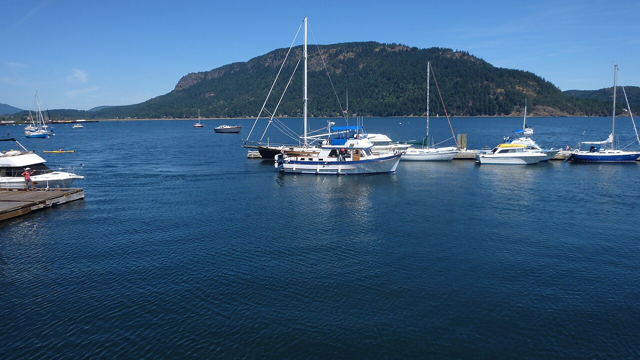
Maple Bay, about ten minutes east of Duncan, sits on a natural harbour looking across Sansum Narrows to Salt Spring Island. Bird's Eye Cove, at the south end of the bay, shelters a marina and a yacht club. Homes climb the slopes of Mount Tzouhalem and Maple Mountain behind the water. Over the shoulder of Mount Tzouhalem, Genoa Bay is a small cluster of waterside homes around its own marina.
Westholme
North of Duncan, Westholme fills the Chemainus River valley between Mount Sicker and Crofton, with the Halalt First Nation's reserve to the northeast. Farming has shaped it since early settlement, and the Island Highway and the old E&N rail line run past hobby farms and large rural properties, some still held by descendants of the first settler families.
Chemainus, the mural town at the north end of North Cowichan, and Ladysmith beyond it are covered with the Nanaimo area on this site; see Nanaimo and Parksville real estate for both towns.
Cowichan Bay
Cowichan Bay, the community of the regional district's Electoral Area D, is a seaside village near the mouths of the Cowichan and Koksilah rivers. Settlers landed here from HMS Hecate in 1862, and by 1900 steamers called at the government dock. The village along Cowichan Bay Road now mixes marinas, small shops and the Cowichan Bay Maritime Centre, where the Wooden Boat Society teaches boat building, and in 2009 it became the first Cittaslow, or slow city, community in North America.
Hecate Park has a beach, a boat launch and the Cowichan Estuary Nature Centre, and the estuary draws migrating birds in spring and fall. Cowichan Tribes reserves line part of the south shore. Homes climb the hillside above the village and rural lots run back toward Cobble Hill.
Crofton, Saltair and Thetis Island
Crofton sits on Osborne Bay below Maple Mountain. Henry Croft bought land here in 1900 for a copper smelter and the townsite was laid out in 1902; the smelter soon closed, and from 1957 a pulp and paper mill beside the town was the main employer until its permanent closure was announced in 2025. BC Ferries sails about 20 minutes from Crofton to Vesuvius Bay on Salt Spring Island, and a seawalk runs from the ferry wharf to Crofton Beach. The town is part of North Cowichan, with its own elementary school.
Saltair is the rural community of Electoral Area G, spread along Stuart Channel between Chemainus and Ladysmith on larger lots facing Thetis Island. Thetis Island itself is about 10 km² with a few hundred residents, reached by a 25-minute ferry from Chemainus to Preedy Harbour; the route continues to Penelakut Island, home of the Penelakut First Nation. Land use on Thetis is planned by the Thetis Island Local Trust Committee, and the island keeps one of the few one-room schoolhouses left in Canada.
Lake Cowichan, Youbou and Honeymoon Bay
Highway 18 runs 26 km west from the Trans-Canada at Duncan to the Town of Lake Cowichan, at the east end of Cowichan Lake, where the Cowichan River begins and flows through the middle of town. The lake is about 30 km long and up to 4 km wide, and much of its shore stayed undeveloped for decades because timber companies held the land around it. The town was incorporated in 1944 and grew on logging and sawmills, which employed many Sikh workers; through the 1970s and 1980s the mill towns around the lake were centres of the valley's Sikh community.
Lake Cowichan real estate includes town lots and newer subdivisions within walking distance of the lake and river, older mill-era houses, and lakefront and riverfront homes. The town has Palsson Elementary and Lake Cowichan School for older grades, and the Ts'uubaa-asatx Nation, formerly the Lake Cowichan First Nation, has its reserve on the lake's north bank.
Youbou, about 13 km west along the north shore, was named after two officials of the Empire Lumber Company, which ran its first sawmill. Mesachie Lake and Honeymoon Bay are on the south shore, near the sandy beach of Gordon Bay Provincial Park and the Honeymoon Bay Ecological Reserve, which protects a large stand of pink fawn lilies. Both shores mix year-round homes with cabins and recreational lots.
Quw'utsun and the Other First Nations of the Valley
The valley is the home of the Quw'utsun people. Cowichan Tribes, with more than 5,500 members, is the largest single First Nation band in British Columbia, and its nine reserves, about 24 km² in all, lie mainly along the lower Cowichan River beside Duncan and around Cowichan Bay. Its historic villages included Quamichan, Comiaken, Koksilah, Somenos, Clemclemaluts and Khenipsen, names that survive on the valley's lakes, rivers and roads, and Quw'utsun knitters are known for the Cowichan sweater. Other Nations in the area include the Penelakut on Penelakut Island, the Halalt near Westholme and the Ts'uubaa-asatx at Cowichan Lake.
Hospital, Schools and Getting Around
Health Care
Cowichan District Hospital on Gibbins Road in Duncan is Island Health's acute-care hospital for the valley, with a 24-hour emergency department and an intensive care unit. Island Health is replacing it with the Quw'utsun Valley Hospital (Quw'utsun Hulitun-ew't-hw) on Bell McKinnon Road in North Cowichan, a far larger building with 204 beds, seven operating rooms, an expanded emergency department and on-site MRI.
Schools and Vancouver Island University
Public schools from Mill Bay to Chemainus and Lake Cowichan belong to School District 79 (Cowichan Valley). In the Duncan area, students attend Quamichan School for grades 8 and 9 and Quw'utsun Secondary, opened in 2025 on University Way, for grades 10 to 12, while Chemainus Secondary, Lake Cowichan School and Frances Kelsey Secondary in Mill Bay serve the other ends of the valley. Vancouver Island University's Cowichan campus, opened next door in 2011, offers first- and second-year university courses, trades and career programs and upgrading.
Highways, Ferries and Transit
The Trans-Canada Highway runs through the middle of Duncan as a four-lane street, north to Ladysmith and Nanaimo and south over the Malahat to Victoria, and Highway 18 branches west to Lake Cowichan. Besides the Gulf Islands ferries from Crofton and Chemainus, the Mill Bay to Brentwood Bay ferry crosses Saanich Inlet in about 25 minutes. Cowichan Valley Regional Transit runs from its Duncan exchange to Maple Bay, Crofton, Chemainus, Lake Cowichan, Youbou and Mill Bay, and the Route 66 Cowichan-Victoria Express carries commuters to downtown Victoria.
Rivers, Lakes, Trails and Wine Country
The Cowichan River runs 47 km from Cowichan Lake to the estuary at Cowichan Bay and was designated a Canadian Heritage River in 2003. It is known for salmon, steelhead and trout, and Cowichan River Provincial Park follows its middle reaches with campsites and a historic footpath of about 20 km toward Skutz Falls.
The Cowichan Valley Trail, part of the Trans Canada Trail, follows old rail grades from Cowichan Lake through Glenora to the Kinsol Trestle, a timber rail trestle about 44 m high over the Koksilah River near Shawnigan Lake, reopened to trail users in 2011. Mount Tzouhalem rises 536 m between Quamichan Lake, Maple Bay and Cowichan Bay, with a Garry oak ecological reserve on its southwest slopes, and North Cowichan's Municipal Forest Reserve, more than 5,000 hectares on six hills including Mount Prevost and Maple Mountain, is open to hikers, cyclists and riders. Somenos Lake, on the north edge of Duncan, is winter habitat for ducks, geese and trumpeter swans. Farms and vineyards fill the valley floor, and in 2020 the province recognized the Cowichan Valley as a wine sub-region, the first in British Columbia outside the Okanagan.
A Short History of the Cowichan Valley
Quw'utsun villages lined the Cowichan River and Cowichan Bay for thousands of years. The colonial government kept settlers out of the valley until 1862, and North Cowichan was incorporated in 1873. The Esquimalt and Nanaimo Railway arrived in 1886, when Prime Minister John A. Macdonald drove its last spike at Cliffside near Shawnigan Lake, and Duncan grew around its station. Copper was mined in the hills near Duncan from 1897 to 1908, and logging and sawmills at Chemainus, Cowichan Lake and Youbou, and later the Crofton pulp mill, carried the economy through most of the 20th century. As the mills declined, farming, wine, tourism, health care and education grew, and the mild climate drew retirees.
Cowichan Valley Real Estate by Property Type
Each property type has its own page with listings, a map, statistics and a market report.
Houses
Detached homes are the bulk of the market, from character houses near downtown Duncan and North Cowichan subdivisions to lake cottages and rural homes. Browse Cowichan Valley houses for sale.
Condos
Apartment condos cluster in and around downtown Duncan, with a handful in Lake Cowichan, Crofton, Cowichan Bay and Mill Bay. See Cowichan Valley condos for sale.
Townhomes
Townhouse complexes are concentrated on the west side of Duncan and in North Cowichan, with smaller groups at the lake and in Cowichan Bay. See Cowichan Valley townhomes for sale.
Waterfront
Oceanfront at Maple Bay, Genoa Bay, Cowichan Bay, Saltair and Thetis Island, lakefront on Cowichan Lake and riverfront on the Cowichan and Koksilah. Browse Cowichan Valley waterfront properties.
View Homes
Hillside homes look toward Salt Spring Island, across the valley farmland or down the length of Cowichan Lake. See Cowichan Valley view homes.
Luxury Homes
Homes at $2 million and above are mostly oceanfront at Maple Bay and Genoa Bay, lakefront, or estate acreage. See Cowichan Valley luxury homes.
Acreages and Land
One acre or more, including bare land, in Cowichan Station, Glenora, Sahtlam, Westholme, Saltair and on Thetis Island. Browse Cowichan Valley acreages and land.
Age-restricted buildings, complexes and parks, mainly in and around Duncan, with more at the lake and in South Cowichan. Browse Cowichan Valley 55+ properties.
Manufactured Homes
Homes in parks on the edges of Duncan and in South Cowichan, and on their own lots around the lake. See Cowichan Valley manufactured homes.
Before you write an offer, confirm which local government the property is under (Duncan, North Cowichan, Lake Cowichan, a regional district electoral area or the Islands Trust on Thetis), since zoning, permits and services differ; whether water and sewer are municipal or come from a well and septic system; and whether the land is freehold or leased. Dikes on the lower Cowichan and Koksilah rivers protect much of Duncan and its neighbours, but low ground near the rivers and the estuary still calls for a flood-risk check. BC's speculation and vacancy tax applies in Duncan, North Cowichan and the Town of Lake Cowichan. The home buying guide walks through each stage of buying a home.
Search Cowichan Valley MLS® Listings
Use the listings and map at the top of this page to compare homes, condos, waterfront and land from Cowichan Bay and Duncan to Crofton, Thetis Island and the far end of Cowichan Lake, or open one of the property-type pages above for a narrower search. Valley-wide prices, inventory and days on market are tracked in the Cowichan Valley Market Report.




 Houses
  Condos
  Townhomes
  Waterfront
  View Homes
  Luxury Homes
  Acreages & Land
  Pet-Friendly
  55+ Homes
  Manufactured
  Homes with Suites
  All Vancouver Island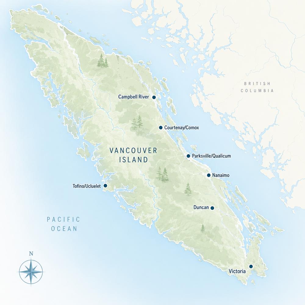

.jpg)