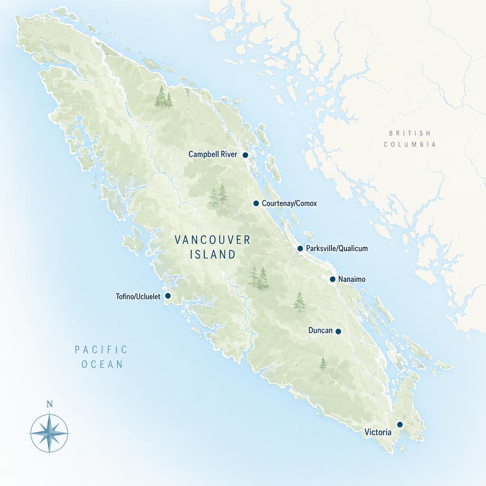
Loading current Nanaimo & Parksville Acreages & Land…
Currently Available—Current acreage listingsAverage Listing Price—Current acreage averageAverage Bedrooms—Current acreage averageAverage Bathrooms—Current acreage averageAverage Living Area—Interior living areaAverage Price / Ft²—Current acreage average
Listings, map and statistics cover properties of one acre or more in Nanaimo, Lantzville, Nanoose Bay, Parksville, Qualicum Beach, Errington, Coombs, Qualicum Bay, Bowser, Cedar, Gabriola Island, Ladysmith and Chemainus, listed through the Vancouver Island Real Estate Board. For the whole Island, see Vancouver Island acreages and land.
Hobby farms, horse properties, forested parcels and building land from Cedar and Yellow Point to Errington, Coombs, Bowser, Ladysmith and Gabriola Island.
Browse Nanaimo and Parksville acreages and land for sale, from hobby farms, horse properties and houses on an acre or more to forested lots, bare rural parcels and larger development sites listed on the MLS® from Chemainus and Ladysmith north through Cedar, Nanaimo and Nanoose Bay to Errington, Coombs, Qualicum Bay and Bowser.
The land falls into three broad bands. Small acreages of a few treed acres ring Nanaimo, Lantzville, Parksville and Qualicum Beach. The farm valleys of Errington, Coombs and Hilliers, and the farms of Cedar and Yellow Point, carry hay fields, pasture and Agricultural Land Reserve land. Farther inland, toward the Nanaimo Lakes road, Horne Lake and the Beaufort Range, parcels get larger, steeper and more heavily forested.
Most acreage here lies outside city limits, in rural electoral areas run by the Regional District of Nanaimo (RDN) or, around Ladysmith and Chemainus, the Cowichan Valley Regional District. Zoning, water and farm rules change from one road to the next, so the sections below take each community in turn.
The listings at the top of this page include every property of one acre or more in the area. They mix acreage homes and hobby farms with bare rural land and a share of commercial, industrial and multi-family sites inside Nanaimo, Parksville and Lantzville that meet the same size test. Filter by property type if you want only homes or only vacant land.
The mailing address is a poor guide to the rules. A property with a Nanaimo address may sit in Cedar, South Wellington or Extension and fall under the regional district, not the city. A Qualicum Beach address can belong to Dashwood, Little Qualicum or Meadowood, and many Ladysmith addresses are in Saltair or Diamond, in the Cowichan Valley Regional District. Confirm the jurisdiction on the title or the BC Assessment record before you read any zoning bylaw.
South of the Nanaimo River, the RDN's Electoral Area A takes in Cedar, South Wellington, Yellow Point and Cassidy. It is the closest large pocket of rural land to Nanaimo, and acreages here run from treed lots of a few acres off Cedar Road and Yellow Point Road to fenced hobby farms, horse properties and waterfront acreage on Stuart Channel.
Inland, Quennell Lake and Holden Lake add small-lake frontage, and Hemer Provincial Park preserves forest and wetland in the middle of the Yellow Point farms. Cassidy, beside Nanaimo Airport and the Trans-Canada Highway, and South Wellington, near Morden Colliery Historic Provincial Park, offer rural parcels with quick highway access, some backing onto the Nanaimo River or Haslam Creek. Part of the farmland across Area A is in the Agricultural Land Reserve, so check each parcel's status before planning a second home or a subdivision.
Nanaimo, Lantzville and Nanaimo Lakes Acreages
Inside the City of Nanaimo, one-acre-plus properties sit mostly at the rural edges, in North Jingle Pot and Pleasant Valley and on the southern fringe toward Cedar. Some are large estate homes with room for a shop or a horse; others are older homes on land the city's plans mark for future housing, which list for their development potential rather than as acreage to keep.
West of the city, Electoral Area C covers Extension, East Wellington and the Nanaimo Lakes road, where parcels are bigger and border private managed forest. North of Nanaimo, the District of Lantzville has its own zoning: Upper Lantzville, on the slopes above the Island Highway, holds rural lots and small acreages, while Lower Lantzville's larger parcels sit closer to the water and the village.
Nanoose Bay and Parksville Acreages
Nanoose Bay, Electoral Area E, is better known for oceanfront and golf-course homes, but it also has rural acreage along Northwest Bay Road and in the valley behind the head of the bay. The ground is often rocky and sloping, which brings views of the Strait of Georgia and the Ballenas Islands but limits pasture and building sites.
Parksville itself has little acreage inside city limits. The rural land around it belongs to Electoral Area G, which covers Englishman River, French Creek, San Pareil, Little Qualicum and Dashwood. Acreages along the Englishman River and French Creek combine treed lots with river frontage, and riparian setbacks under the province's Riparian Areas Protection Regulation shape what can be built near the water.
Errington, Coombs and Hilliers Acreages
Inland from Parksville, Electoral Area F (Coombs, Hilliers, Errington, Whiskey Creek and Meadowood) is the area's main farm district. The RDN's agricultural area plan counted more than 5,000 hectares zoned for agriculture in Area F alone, and the landscape shows it: hay fields, pasture, small livestock operations, berry farms and horse properties with views of Mount Arrowsmith.
Englishman River Falls Provincial Park lies southwest of Errington, and Little Qualicum Falls Provincial Park sits west of Coombs on the highway to Port Alberni. Area F is the one RDN electoral area with its own zoning bylaw, Bylaw 1285, so parcel sizes, permitted farm uses and second-dwelling rules here differ from the rest of the regional district.
Across the RDN, the most common farm products are hay and forage, berries and tree fruit, with beef cattle, small-scale poultry and sheep the main livestock. An Errington or Coombs acreage that already carries fencing, a well with good yield and a hay or pasture history is usually worth more to a farming buyer than a larger treed parcel next door.
Bare Land in the Valley
Vacant parcels are part of the mix in Errington, Coombs and Hilliers. Before you buy, ask the RDN about minimum parcel size, the number of dwellings allowed and any development permit areas for streams and wetlands, and budget for a well, a septic system designed by an Authorized Person, a driveway and a BC Hydro connection.
Qualicum Beach, Qualicum Bay and Bowser Acreages
The Town of Qualicum Beach has some larger lots on its outskirts, but much of the acreage sold with a Qualicum Beach address lies in the surrounding electoral areas: Dashwood and Little Qualicum in Area G, and Meadowood in Area F. Many are small acreages with a house, a shop and room for a garden, a short drive from the village.
North along the Oceanside Route, Electoral Area H covers Bowser, Qualicum Bay and Deep Bay. Here acreages lie between the shoreline and the Inland Island Highway, with forested parcels, rural homes and some oceanfront acreage looking toward Baynes Sound and Denman Island. Inland, Horne Lake and Spider Lake and their provincial parks bring lake and forest country close by.
Ladysmith, Saltair and Chemainus Acreages
At the south end of the area, acreage falls under different governments. Inside the Town of Ladysmith, acreage is limited to the edges of town, and the rural land around it is in the Cowichan Valley Regional District: Diamond and North Oyster in Electoral Area H, and Saltair, with Thetis Island and the other Gulf Islands, in Electoral Area G. Saltair acreages along Chemainus Road look over Stuart Channel, and some reach the water.
Chemainus falls under North Cowichan's municipal zoning, where most rural zones already allowed two dwellings before the province's small-scale housing changes. Rural acreage around Chemainus follows the Chemainus River valley and the farmland toward Westholme, with forested parcels on the slopes west of the highway.
Gabriola Island Acreages
Gabriola Island is the RDN's Electoral Area B, but the Islands Trust, not the regional district, writes its zoning, so minimum lot sizes, subdivision and the number of dwellings on an island acreage follow the Trust's bylaws. Acreages range from forested parcels in the island's interior to waterfront lots along its shoreline.
Every Gabriola property supplies its own water, from a well, rainwater capture or both, and well depth and yield vary widely across the island. Judge an island acreage on its water records and storage first, ahead of the house and the view.
Zoning, ALR and Taxes on Rural Land
Regional District of Nanaimo Zoning
The RDN's Zoning Bylaw 2500 replaced the long-standing Bylaw 500 for Electoral Areas A, C, E, G and H. Area F keeps Bylaw 1285, and Area B is zoned by the Islands Trust. The municipalities of Nanaimo, Lantzville, Parksville and Qualicum Beach each have their own bylaws, as do Ladysmith and North Cowichan to the south.
The Agricultural Land Reserve
The RDN's agricultural area plan put roughly a tenth of the regional district's land base in the Agricultural Land Reserve, much of it in Errington, Coombs and Hilliers, and a share of it still forested. ALR land is overseen by the Provincial Agricultural Land Commission, which limits house size, additional residences, subdivision and non-farm uses; the Vancouver Island acreages and land page sets out those rules, farm classification and the water and septic checks in detail.
Speculation and Vacancy Tax
Of the local governments here, only the municipalities (Qualicum Beach, Parksville, Lantzville, Nanaimo, Ladysmith and North Cowichan) fall inside BC's speculation and vacancy tax area. Rural acreage in the RDN and Cowichan Valley electoral areas, and land on Gabriola Island, is outside it, which matters if the property will be a second home.
Checking an Acreage in This Area
On any parcel here, confirm which government zones it, its ALR status, well yield and water quality, the septic filing with Island Health, legal access, and any streamside or floodplain limits along the Englishman, Little Qualicum, Nanaimo or Chemainus rivers. Waterfront acreage also needs the shoreline checks on the Nanaimo and Parksville waterfront page, and the general steps of a purchase are on the buying a home page.
Nanaimo and Parksville Acreage Buyer Note
Before writing an offer on rural land between Ladysmith and Bowser, find out whether the parcel answers to the RDN, the Cowichan Valley Regional District, a municipality or the Islands Trust, then check the zoning bylaw that applies, the ALR map, the well and septic records, and whether the speculation and vacancy tax reaches the property.
Search Nanaimo & Parksville Acreage and Land MLS® Listings
Use the listings and map at the top of this page to compare hobby farms in Errington and Coombs, treed acreages in Cedar and Yellow Point, rural lots around Qualicum Beach and Bowser, and land near Ladysmith, Chemainus and on Gabriola Island. For every property type in the area, return to the Nanaimo and Parksville real estate page, and for asking prices and market times see the Nanaimo and Parksville Acreages & Land Market Report.







 All Properties
 Houses
 Condos
 Townhomes
 Waterfront
 View Homes
 Luxury Homes
 Pet-Friendly
 55+ Homes
 Manufactured
 Homes with Suites