Loading current Comox Valley & Campbell River Acreages & Land…
Currently Available—Current acreage listingsAverage Listing Price—Current acreage averageAverage Bedrooms—Current acreage averageAverage Bathrooms—Current acreage averageAverage Living Area—Interior living areaAverage Price / Ft²—Current acreage average
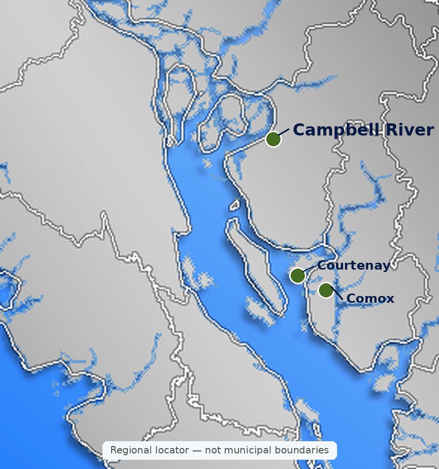
Listings, map and statistics cover properties of one acre or more, with or without a home, in Courtenay, Comox, Cumberland, Royston, Union Bay, Fanny Bay, Merville, Black Creek, Denman Island, Hornby Island, Campbell River and Quadra Island, as listed through the Vancouver Island Real Estate Board. For the whole Island, see Vancouver Island acreages and land.
Comox Valley & Campbell River Acreages & Land for Sale
Hobby farms, rural homes, forested parcels and bare land of one acre or more, from the farm country of Merville and Black Creek to Baynes Sound, the islands and Campbell River.
Farms, Acreages and Rural Land in the Comox Valley
Browse Comox Valley acreages and land for sale: homes on one acre or more, hobby farms and working farms, horse properties, forested parcels, waterfront acreage and vacant building land, from Fanny Bay and the Baynes Sound shore north through Courtenay, Comox, Merville and Black Creek to Campbell River and Quadra Island.
The valley's farmland lies on the coastal lowlands and along the Tsolum, Puntledge and Courtenay rivers, and the Agricultural Land Reserve covers about 14% of the Comox Valley Regional District's land. West of the farms the ground climbs through private forest toward Mount Washington and the Comox Glacier, and around Campbell River most acreage is forested and cut by rivers and lakes.
Who sets the rules depends on the parcel. Courtenay, Comox, Cumberland and Campbell River zone their own land, the Comox Valley Regional District zones rural Electoral Areas A, B and C, the Strathcona Regional District covers the rural land around Campbell River and Quadra Island, and the Islands Trust plans Denman and Hornby. A Courtenay or Comox mailing address often belongs to a rural parcel outside the city or town.
This page shows every Comox Valley and Campbell River property of one acre or more listed through the Vancouver Island Real Estate Board, whether it holds a farmhouse, a new custom home, a cabin, a manufactured home or nothing at all. A few strata condos and townhomes can also appear because their listing records the size of the whole complex's land; filter by property type to set them aside.
Parcels close to town services usually cost the most per acre. Larger and cheaper-per-acre land is more common toward the mountains, on the islands and in the forest country around Campbell River, where the savings are often offset by longer drives, private roads and the cost of bringing in power.
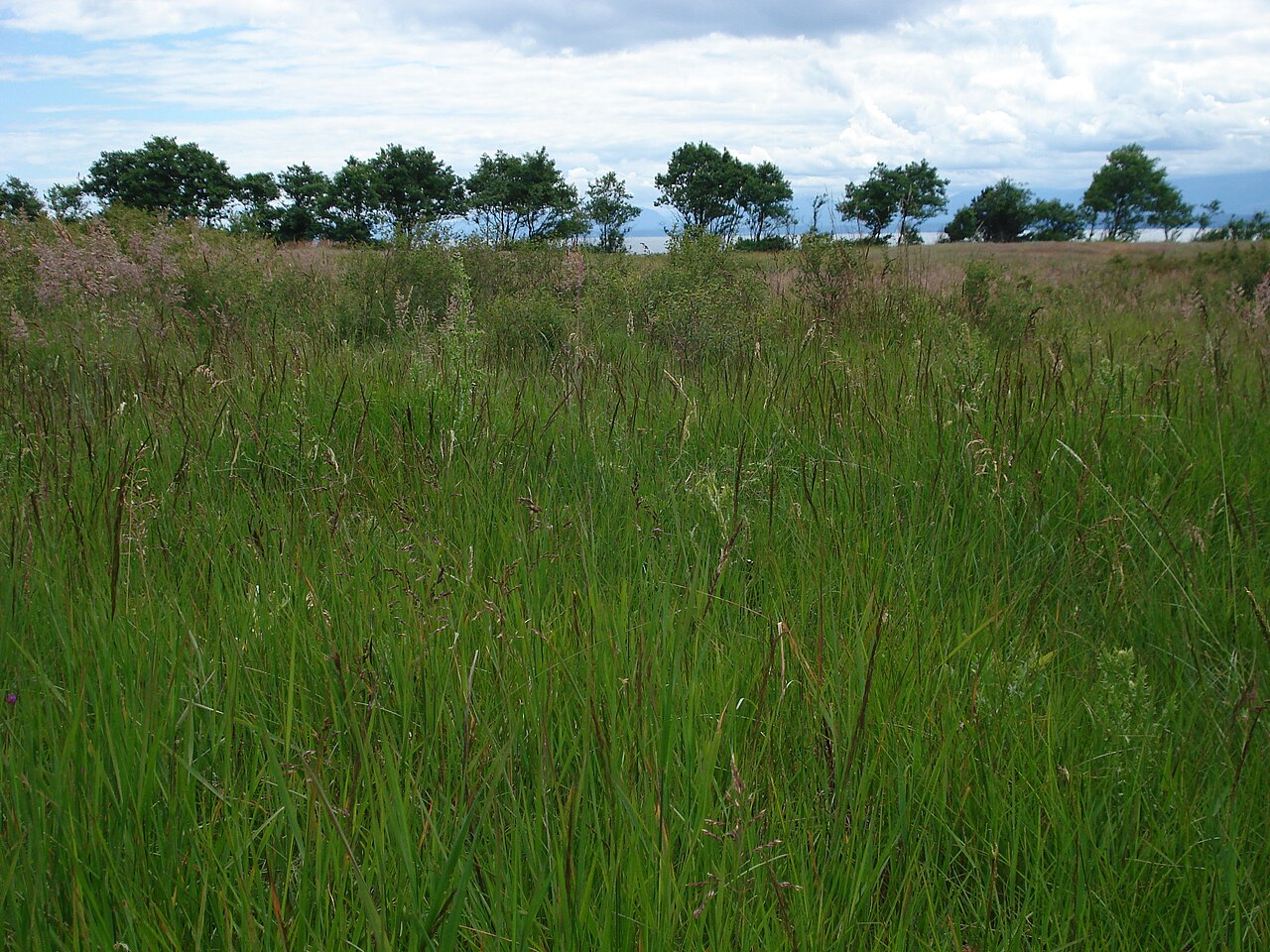
Merville and Black Creek, north of Courtenay in the regional district's Electoral Area C, are the valley's main farm country. Hay fields, dairy and beef operations, berry and vegetable growers and hobby farms share the land between the Inland Island Highway and the old Island Highway along the coast, and much of it is in the Agricultural Land Reserve. Parcels run from a few acres with a house and a barn to large working farms.
Closer to the water, Saratoga Beach and the land around Miracle Beach Provincial Park add treed acreage within reach of sandy beaches, while Dove Creek, also in Area C, holds more farms and rural homes on the way west toward Mount Washington. Some neighbourhoods around Black Creek are on a regional district water service; most acreage relies on wells.
Water for Farming
Summer water is the limit on many valley farms. The regional district's agricultural planning work found that irrigation accounts for most water use in the Tsolum River watershed, which drains much of this farmland, and that streams run very low from July to October. If you plan to irrigate, ask whether the farm holds a surface water licence or a licensed well, not only a domestic well.
Courtenay, Comox and Cumberland Acreages
Inside the three municipalities, most land is serviced residential lots, and parcels of an acre or more are uncommon. The acreage market around them sits in the regional district: hobby farms and treed parcels on the Comox Peninsula around Lazo and Little River in Electoral Area B, rural homes off Forbidden Plateau Road and along the Puntledge River west of Courtenay, and acreage near the coast north of the peninsula toward Seal Bay Regional Nature Park.
Cumberland's village boundary takes in forest as well as town, and most rural parcels within reach of its trails lie in the surrounding electoral areas rather than inside the village. Buyers who want acreage near Cumberland should expect to compare regional district zoning, not village zoning.
Edge-of-Town Land and Subdivision Potential
The Comox Valley's regional growth strategy steers new homes into the municipalities and designated settlement areas and keeps new rural lots large, with smaller lots allowed only where farming is the principal use. Land on the edge of Courtenay or Comox can carry development value, but check the official community plan designation as well as the zoning before paying for subdivision potential.
Royston, Union Bay and Fanny Bay Acreages
South of Courtenay, Electoral Area A runs along Baynes Sound. Rural acreage sits on the slopes above the old Island Highway, with views to Denman Island from the higher ground, and the land between the coast road and the Inland Island Highway mixes forest, small farms and rural homes. Fanny Bay is the most rural of the three, and Buckley Bay, between Union Bay and Fanny Bay, is the ferry terminal for Denman Island.
Shellfish Waters and Drainage
The regional district reports that Baynes Sound produces more than half of the shellfish grown in BC, and its growth strategy asks that development not harm shellfish tenures through stormwater. Expect close attention to drainage, septic setbacks and runoff on any parcel that drains to the sound.
Denman and Hornby Island Acreages
Denman Island, a short ferry ride from Buckley Bay, and Hornby Island, one more crossing beyond it, add island acreage of every kind, with farmland in the Agricultural Land Reserve, forest and waterfront parcels. Land use is set by the Denman and Hornby local trust committees of the Islands Trust, whose mandate is to preserve and protect the islands, and the Province's small-scale multi-unit housing rules do not apply there.
Groundwater is the main water source on both islands, so late-summer well yield and, near the shore, the risk of salt water are the first checks on any island parcel. Ferry schedules, the availability of trades and the cost of moving materials over one crossing to Denman or two to Hornby belong in every building budget.
Campbell River and Quadra Island Acreages
Campbell River's zoning bylaw includes rural zones, so some acreage lies inside city limits, where the city issues permits and secondary suites are allowed in the rural zones. Beyond the city, the Strathcona Regional District's Electoral Area D (Oyster Bay–Buttle Lake) takes in rural land south toward the Oyster River and west toward the lakes, with forested parcels and frontage along the Campbell and Quinsam rivers.
Quadra Island, in the regional district's Electoral Area C, has forested acreage, small farms and waterfront parcels. Most islanders live on the south end near Quathiaski Cove and Heriot Bay, while the north end is quieter and more heavily forested. Quadra's land use is set by the Strathcona Regional District, not the Islands Trust.
Buying Acreage in the Comox Valley and Campbell River
The full checklist for wells, septic systems, access, financing and farm class is on the Vancouver Island acreages and land page. These are the local points that come up most often.
The Agricultural Land Reserve
In the Comox Valley, reserve land lies mainly on the coastal lowlands from Fanny Bay to Black Creek and on Denman and Hornby. The regional growth strategy designates Agricultural Areas that follow the reserve's boundaries, and subdivision, non-farm uses and extra dwellings on reserve land need Agricultural Land Commission approval on top of local zoning.
Zoning and Jurisdiction
The Rural Comox Valley Zoning Bylaw (Bylaw No. 520) covers all three electoral areas, with rural zones such as Rural Eight (RU-8), Rural Twenty (RU-20) and Rural ALR (RU-ALR). Courtenay, Comox, Cumberland and Campbell River each have their own zoning bylaws; Quadra and Area D follow Strathcona Regional District bylaws; Denman and Hornby follow the Islands Trust. Look up the zone on the regional district's online map before relying on a listing's description.
Forest Neighbours and Wildfire
Acreage on the west side of the valley and around Campbell River often borders private managed forest, where harvesting returns on a cycle and can open or close a view. Ask about logging plans next door, clear fuel around buildings to FireSmart guidance, and confirm the distance to the nearest fire hall with your insurer. The home buying guide covers the purchase process itself, from offer to completion.
Comox Valley Acreage Buyer Note
Before you buy, confirm which government zones the parcel (a municipality, the Comox Valley or Strathcona regional district, or the Islands Trust), its Agricultural Land Reserve status and plan designation, legal access, late-summer well yield, the septic filing with Island Health, any water licence for irrigation, and setbacks from salmon streams and the Baynes Sound shoreline.
Search Comox Valley & Campbell River Acreage MLS® Listings




 All Properties
 Houses
 Condos
 Townhomes
 Waterfront
 View Homes
 Luxury Homes
 Pet-Friendly
 55+ Homes
 Manufactured
 Homes with Suites