A Short Walk to Downtown
The Johnson Street Bridge puts Old Town and the Inner Harbour within walking distance of much of the neighbourhood, with separated lanes for walking and cycling.


Real Estate Company
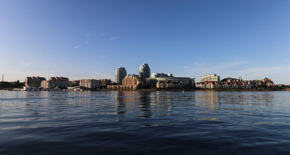
A harbourfront neighbourhood just across the Johnson Street Bridge from Downtown, where the Inner Harbour, the Gorge Waterway, historic railway lands and some of Victoria's oldest working-class streets meet.
Victoria West, known almost everywhere as Vic West, is the City of Victoria's neighbourhood on the west side of the harbour. It covers about 158 hectares between Victoria Harbour and the Gorge Waterway, with the Township of Esquimalt along its western edge. The Johnson Street Bridge and the Bay Street Bridge, along with the Selkirk Trestle on the Galloping Goose Trail, tie it to the rest of the city.
That geography gives Vic West two distinct sides. Its harbour shoreline faces Downtown and the Inner Harbour, with condominium districts, waterfront walkways and floatplane traffic. Inland, it is a grid of older residential streets, small parks and neighbourhood businesses, and along its northern edge it opens onto the quieter, tree-lined water of the Gorge.
It is also a neighbourhood of small households. In the 2016 Census the average Vic West household had 1.9 people and roughly 44 per cent of households were one person living alone, which reflects how much of the neighbourhood's housing is in apartment buildings.
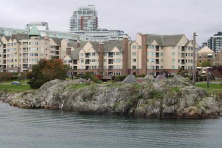
The Johnson Street Bridge puts Old Town and the Inner Harbour within walking distance of much of the neighbourhood, with separated lanes for walking and cycling.
The Galloping Goose Regional Trail and the E&N Rail Trail both run through Vic West, linking it by bike to much of Greater Victoria.
The Inner Harbour, Selkirk Water and the Gorge Waterway wrap around the neighbourhood, with public walkways, parks and a busy summer swim dock.
Victorian cottages and character houses sit a few blocks from the newer towers of Songhees, Bayview and Dockside Green.
Daily life in Vic West tends to revolve around three things: the waterfront, the trails and Westside Village. The City's neighbourhood plan describes Westside Village as the commercial heart of the neighbourhood, with smaller clusters of shops and services along Craigflower Road, on Catherine Street north of Edward Street and near Lime Point.
Many residents get around without a car for at least part of the week. Downtown is a walk or a short ride across the Johnson Street Bridge, the Galloping Goose and E&N Rail Trail carry cyclists toward Esquimalt, the West Shore and beyond, and harbour ferries stop at Dockside Green.
Community life is local and low-key: the Vic West Community Centre beside Banfield Park, community gardens, summer swimming in the Gorge, the skatepark at Victoria West Park, and long-standing gathering places such as Spinnakers, which opened on May 15, 1984 and is now recognized as the oldest brewpub in Canada.
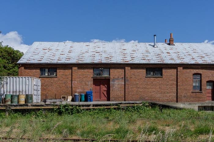
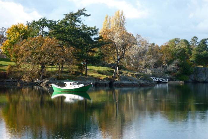
Vic West is compact, but its harbourfront, former railway lands, villages and older residential streets each feel quite different.
The shoreline facing the Inner Harbour is lined with condominium buildings, the Ocean Pointe hotel and the Westsong Walkway. It is the most urban and most visited part of the neighbourhood, with downtown views and floatplanes overhead.
Around the E&N Roundhouse on Esquimalt Road, newer residential towers have risen on the former railway lands, and redevelopment around the heritage buildings is still under way.
Built on former industrial land beside the Upper Harbour, Dockside Green mixes contemporary condominiums with offices, cafes and a harbour ferry stop, right beside the Galloping Goose.
The neighbourhood's main shopping centre and, under the 2018 neighbourhood plan, the focus for new housing, shops and a possible future community facility.
Older residential streets where the streetcar arrived in 1906 and set off a building boom. Many of Vic West's cottages and character houses are found in this part of the neighbourhood.
The Harbour Road industrial lands along the Upper Harbour anchor much of Victoria's maritime industry, a reminder that Vic West is still a working waterfront.
Banfield Park runs along the Gorge Waterway off Craigflower Road. Its expanded swim dock, officially opened in 2024, draws swimmers and paddlers all summer, and the park also has a playground, tennis and basketball courts, a leash-optional dog area and the Banfield Commons food forest. It is named after Charles Banfield, a local alderman and King's Printer.
On Esquimalt Road east of Catherine Street, Victoria West Park has playing fields and a large public skatepark, part of which was rebuilt and modernized in 2016.
The Westsong Walkway follows the shoreline for about 2.3 km, from the Songhees totems near the Johnson Street Bridge to West Bay in Esquimalt. Songhees Park, expanded in 2022 as the first park developed in partnership between the City and the Songhees Nation, adds a Garry oak meadow, coastal bluff gardens and a harbour viewing platform.
The Galloping Goose Regional Trail crosses Selkirk Water on the Selkirk Trestle next to Banfield Park and meets the E&N Rail Trail in Vic West, making cycling a practical way to reach much of Greater Victoria.
Most Vic West homes are in apartment buildings. In the 2016 Census, about 68 per cent of dwellings were apartments, 15 per cent were single-detached houses, 8 per cent were townhouses and about 7.5 per cent were duplexes or houses with suites.
On the ground, that mix ranges from harbourfront concrete towers in Songhees, Bayview and Dockside Green to older low-rise apartment buildings and, on the interior streets, Queen Anne houses and cottages, Edwardian-era homes, bungalows from around 1912 and newer infill.
To see what is on the market now and how prices compare, browse current Vic West listings or the Vic West market report, both of which update with current MLS® data.
Vic West is part of the traditional territory of the Lekwungen-speaking Songhees people. After the Hudson's Bay Company built Fort Victoria in 1843, the Songhees moved their village across the harbour to the shoreline that is now Vic West. It remained there until 1911, when, after lengthy negotiations, the reserve was relocated to Esquimalt and the land was opened to industry.
Prominent families built homes here in the 1880s and 1890s. James Dunsmuir, son of coal baron Robert Dunsmuir, built his Burleith estate in 1892 on about 20 acres. It was subdivided after he became Lieutenant Governor in 1906, and the house was destroyed by fire in 1931, though the name lives on in Burleith Park. Roslyn, built in 1890 on Catherine Street for Andrew Gray of the Albion Iron Works, still stands, and General Sir Arthur Currie lived in Vic West before the First World War.
Most of the neighbourhood was built between the 1890s and 1913. The No. 5 streetcar reached Craigflower Road in 1906 and set off a boom in house building; buses replaced it in 1947. Residents worked for the E&N and BC Electric railways, shipbuilders, lumber mills, breweries, machine shops and foundries.
Vic West was also the scene of Canada's deadliest streetcar accident. On May 26, 1896, a streetcar crowded with 143 passengers on their way to the Queen's birthday celebrations, which included a mock naval battle at Esquimalt, broke through the Point Ellice Bridge, and 55 people died. Today's Bay Street Bridge crosses at the same spot.
The Esquimalt and Nanaimo Railway's roundhouse on Esquimalt Road was completed in October 1913. It was designated a National Historic Site in 1992, and Parks Canada describes it as the most intact steam-locomotive servicing facility in western Canada.
The original Johnson Street Bridge, known locally as the Blue Bridge, opened in January 1924. Its replacement, a single-leaf rolling bascule bridge with separated walking and cycling lanes, opened on March 31, 2018. Industry gradually left the waterfront in the late 20th century, and condominium development along the harbour from the late 1980s began the transformation that continues today at Dockside Green, Bayview and the Railyards.
City Council approved the current Victoria West Neighbourhood Plan on May 10, 2018, replacing the 1986 plan. It directs most new shops and housing to Westside Village and to smaller villages on Craigflower Road and Catherine Street, supports townhouses and houseplexes on streets such as Skinner Street, and keeps the Harbour Road industrial lands for maritime and employment uses.
For anyone choosing a home here, that means nearby change is likely to continue, especially around the villages and the former railway lands. If privacy, sunlight or a particular view matters to you, check the zoning and any development applications near the property first.
See the houses, condos, townhomes and waterfront homes currently listed in Vic West, along with live market statistics for the neighbourhood.
View Vic West PropertiesPhoto credits (cropped and resized): hero photo by Buiobuione, Wikimedia Commons; Songhees Point by Chris Light, Wikimedia Commons; E&N Roundhouse by Michal Klajban, Wikimedia Commons; all licensed CC BY-SA 4.0. Gorge Waterway at Banfield Park by wongo888, Wikimedia Commons, licensed CC BY-SA 3.0.
NOTE: MLS® property information is provided under copyright© by the Vancouver Island Real Estate Board and Victoria Real Estate Board. The information is from sources deemed reliable, but should not be relied upon without independent verification. This website may only be used by consumers for the purpose of locating and purchasing real estate. By registering on this website I/We consent to the collection, use and disclosure of personal information as described in our privacy policy.
The trademarks MLS®, Multiple Listing Service® and the associated logos are owned by The Canadian Real Estate Association (CREA) and identify the quality of services provided by real estate professionals who are members of CREA. Used under license.
Get instant property value now!