Loading current Comox Valley & Campbell River Waterfront…
Currently Available—Current waterfront listingsAverage Listing Price—Current waterfront averageAverage Bedrooms—Current waterfront averageAverage Bathrooms—Current waterfront averageAverage Living Area—Interior living areaAverage Price / Ft²—Current waterfront average
Listings, map and statistics cover oceanfront, riverfront and lakefront homes, condos and land in Courtenay, Comox, Cumberland, Royston, Union Bay, Fanny Bay, Merville, Black Creek, Denman Island, Hornby Island, Campbell River and Quadra Island, as listed through the Vancouver Island Real Estate Board. Shoreline elsewhere north of the Malahat is on the Vancouver Island waterfront page.
Comox Valley & Campbell River Waterfront Properties for Sale
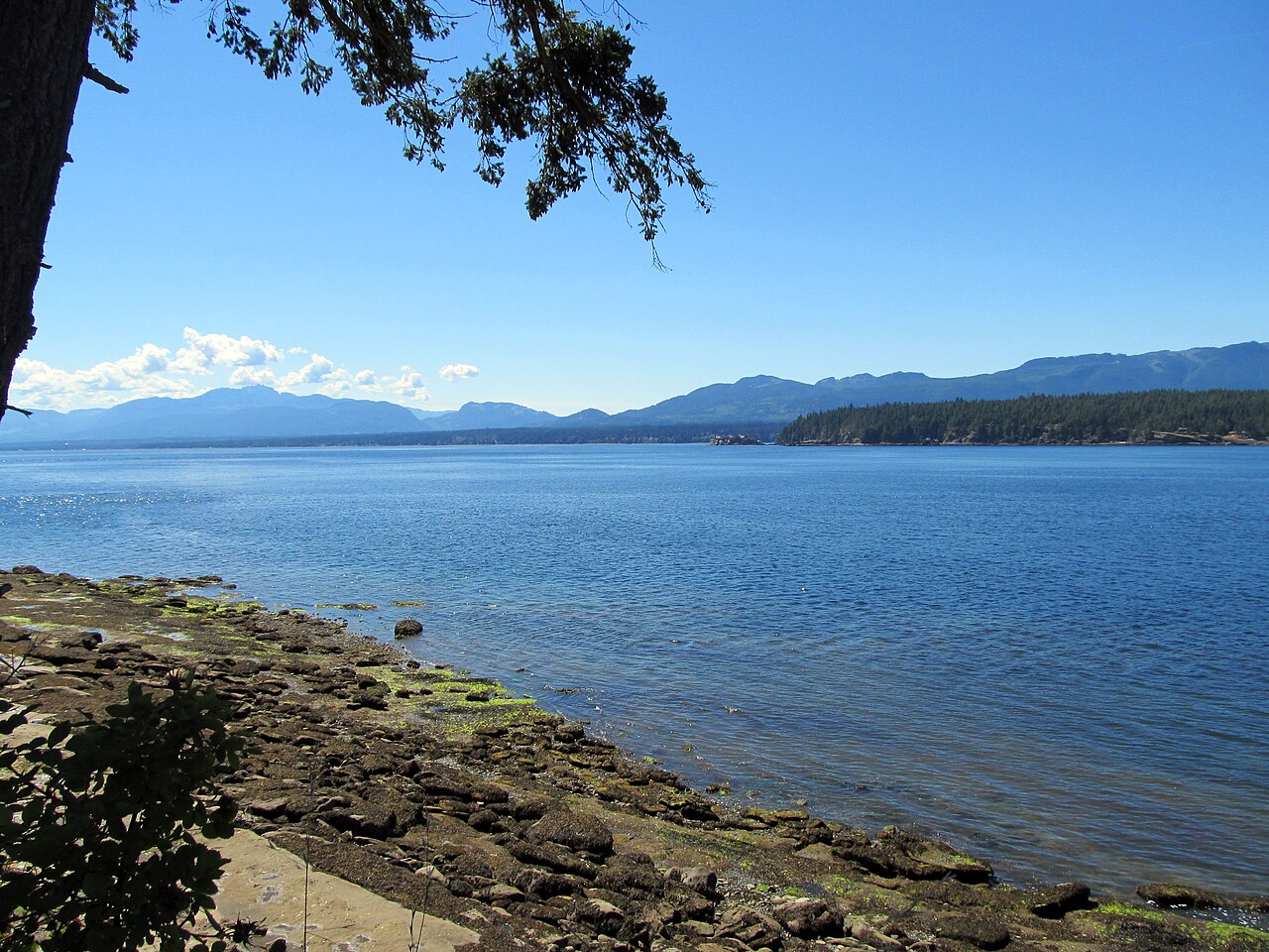
Oceanfront homes on Baynes Sound, the Comox Peninsula and the north valley beaches, waterfront on Denman, Hornby and Quadra islands, and homes and condos facing Discovery Passage.
Oceanfront, Island and Riverfront Property in the Comox Valley
Browse current Comox Valley waterfront homes for sale together with Campbell River and island waterfront: oceanfront houses, beach cottages, waterfront condos, island homes, riverfront properties and shoreline lots listed on the MLS® through the Vancouver Island Real Estate Board.
The shoreline changes character every few kilometres. Baynes Sound is sheltered water lined with shellfish beaches, the Comox Peninsula faces the open Strait of Georgia, the beaches from Kitty Coleman to Saratoga Beach are long and sandy, Discovery Passage at Campbell River runs deep and fast, and Denman, Hornby and Quadra islands add ferry-served shoreline of every kind.
Value follows the beach and the bank as much as the house. A lot with a gentle walk to a usable beach, a bluff-top lot with long stairs, a home with a road or seawalk between it and the water, and a riverfront house with flood setbacks can all carry the waterfront label, so read the shoreline in each listing as carefully as the floor plan.
Comox Valley Waterfront Homes for Sale by Shoreline
Waterfront listings here include year-round family homes, older beach cabins, large new oceanfront houses, condos facing the water and bare shoreline lots. Most are oceanfront, with a smaller group on the Courtenay, Puntledge, Oyster, Campbell and Quinsam rivers and on lakes. The sections below follow the coast from the Comox Peninsula south along Baynes Sound, north to the Oyster River, across to the islands and up Discovery Passage.
The Comox Peninsula holds some of the valley's most sought-after oceanfront. Point Holmes, Kye Bay and the Lazo shoreline face the open Strait of Georgia, with the Coast Mountains across the water, and homes there range from modest older beach houses on small lots to large new houses built on the same frontage. Exposure is the trade-off: these shores take the full force of winter storms off the strait, and homes near the airfield share the sky with 19 Wing's aircraft.
Inside the harbour, Comox oceanfront is limited to a short stretch of the town's shore and a few condo buildings, which look south and west across Comox Harbour to the Beaufort Range and the Comox Glacier. Goose Spit shelters the harbour from the strait, and the marinas in Comox Harbour offer moorage close to home.
The Courtenay River Estuary
At the head of the harbour, a small number of Courtenay condos and homes front the Courtenay River and its estuary. Much of the low ground here lies in the river's floodplain, and the City of Courtenay regulates building in mapped flood areas, so confirm the flood construction level and any covenant on title before buying.
Baynes Sound Waterfront: Royston, Union Bay and Fanny Bay
Highway 19A runs along Baynes Sound from Royston to Fanny Bay, and most waterfront homes here sit between the highway and the beach, looking across the channel to Denman Island. Royston's shore at the head of the harbour includes the breakwater of sunken ships off the end of Hilton Road, Union Bay has waterfront near its heritage row and boat launch, and Fanny Bay adds the Ships Point peninsula, a rural enclave of waterfront homes on quiet roads, and the shoreline around Buckley Bay.
Baynes Sound is one of the most productive shellfish-growing waters in British Columbia, and much of its foreshore is leased for commercial oyster and clam farming. Shellfish on a tenure belong to the tenure holder, whose corners are marked with red concrete markers, so check the provincial tenure maps for the beach in front of any property and expect farm activity at low tide. Between Union Bay and Buckley Bay, the province has set aside a stretch of beach beside the highway as the Baynes Sound Recreational Shellfish Reserve for public harvesting. Low-lying homes on this shore also need a look at the regional district's coastal flood mapping.
North Valley Beaches: Merville, Kitty Coleman and Black Creek
North of Comox, the shoreline of Merville and Black Creek faces the Strait of Georgia, with Kitty Coleman Beach Provincial Park, Miracle Beach Provincial Park and the long sandy beach at Saratoga Beach among the public access points. Waterfront here includes older beach cottages, newer year-round homes, a few beach-area townhomes and some large custom houses. The Oyster River, at the northern edge of the Comox Valley Regional District, adds river and estuary frontage.
These communities sit in the regional district's Electoral Area C, and most homes rely on wells or small water systems and on septic systems, which close to the shore face setbacks and limited replacement space. Summer brings campers and day visitors to the provincial parks, which some owners welcome and others find busy.
Comox Valley Riverfront and Comox Lake
Inland, a modest number of properties front the Puntledge and Tsolum rivers around Courtenay and the Oyster River at the north end of the valley. Riverfront brings salmon runs, privacy and green outlooks, along with flood mapping, bank erosion and streamside protection rules that limit clearing and building near the water, so a riverfront lot often has less usable land than its size suggests.
Comox Lake, west of Cumberland, is a BC Hydro reservoir and the main source of drinking water for the Comox Valley. Much of its watershed is private forest land, cabins are clustered at the east end, and camping, fires and off-road vehicles are restricted to protect the water, so lakefront there is rare and comes with rules that a buyer should read first.
Denman and Hornby Island Waterfront
Denman Island waterfront divides by shore. The west side faces Baynes Sound and the Vancouver Island mountains, often with shellfish tenures on the foreshore, while the east side looks across Lambert Channel to Hornby Island and the open strait. Hornby's waterfront ranges from sandstone shelves and bluffs to coves and beaches around Tribune Bay and Ford Cove, and properties are in short supply.
On both islands, Islands Trust land use bylaws govern new building and shoreline work near the water. Water supply is critical: wells near the shore can be limited or turn brackish in late summer, so many owners add rainwater cisterns. Two ferries stand between Hornby and Vancouver Island, which matters for trades, building supplies and emergencies.
Campbell River Waterfront Properties
Most Campbell River waterfront faces Discovery Passage, the narrow channel between Vancouver Island and Quadra Island used by cruise ships, tugs and fishing boats on the Inside Passage. Along the Island Highway between Willow Point and downtown, waterfront homes and condos sit on the water side of the road; check whether the seawalk, a public walkway or a road allowance lies between the home and the beach, and where the legal boundary falls. Strong tidal currents and winter storms are a factor for any dock, stairway or seawall on this open shore.
North of downtown, Campbell River North has larger oceanfront lots and large custom homes facing the passage toward Seymour Narrows, where the currents are among the fastest on the coast. Inland, the Campbell and Quinsam rivers add riverfront in some of the best-known salmon water on the Island, with floodplain and streamside setbacks to check, and lakes and BC Hydro reservoirs west of the city offer lakefront homes and cabins where water levels rise and fall with dam operations.
Quadra Island Waterfront
Quadra Island waterfront runs from the west shore facing Campbell River, around Quathiaski Cove and Cape Mudge, to the sheltered east-side bays at Heriot Bay and Hyacinthe Bay and the remote north end toward Granite Bay and Surge Narrows. Protected bays on the east and north sides suit docks and moorage better than the Discovery Passage shore, which shares Campbell River's currents.
Quadra waterfront includes simple cabins, year-round family homes and some of the area's largest estates. The island is outside the Islands Trust; land use is set by the Strathcona Regional District, and most homes depend on wells, septic systems and the ferry from Campbell River.
Buying Waterfront in the Comox Valley and Campbell River
The Vancouver Island waterfront page covers the province-wide checks on foreshore rights, docks on Crown land, erosion, wells and septic. Locally, add the shellfish tenure maps for Baynes Sound and Denman, the City of Courtenay's floodplain rules and the regional district's coastal flood mapping, Islands Trust permits on Denman and Hornby, and the exposure of Discovery Passage and the open strait when judging docks, decks and insurance. General purchase steps are in the home buying guide.
Comox Valley Waterfront Buyer Note
Before buying waterfront here, confirm the legal boundary and whether a road, walkway or seawalk separates the property from the shore, any shellfish tenure on the foreshore, flood mapping and construction levels, approvals for existing docks and seawalls, well yield and salinity, septic setbacks, and insurance for a site exposed to storms and tidal currents.
Search Comox Valley & Campbell River Waterfront MLS® Listings




 All Properties
  Houses
  Condos
  Townhomes
  View Homes
  Luxury Homes
  Acreages & Land
  Pet-Friendly
  55+ Homes
  Manufactured
  Homes with Suites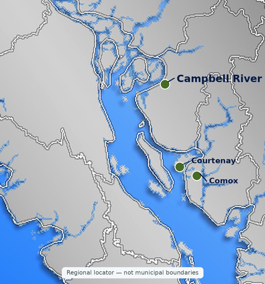

.jpg)