Currently Available—Current waterfront listingsAverage Listing Price—Current waterfront averageAverage Bedrooms—Current waterfront averageAverage Bathrooms—Current waterfront averageAverage Living Area—Interior living areaAverage Price / Ft²—Current waterfront average
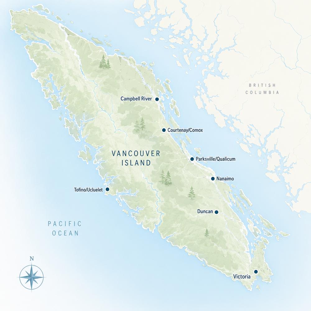
Listings, map and statistics cover oceanfront, lakefront and riverfront properties in Nanaimo, Lantzville, Nanoose Bay, Parksville, Qualicum Beach, Errington, Coombs, Qualicum Bay, Bowser, Cedar, Gabriola Island, Ladysmith and Chemainus, as listed through the Vancouver Island Real Estate Board. For the whole Island, see Vancouver Island waterfront properties.
Nanaimo & Parksville Waterfront Properties for Sale
Oceanfront, lakefront and riverfront homes, condos and lots from Ladysmith Harbour and Yellow Point to Nanaimo's north-end points, Nanoose Bay, the Parksville and Qualicum beaches and Deep Bay.
Browse current Nanaimo and Parksville waterfront homes for sale: oceanfront houses, waterfront condos and townhomes, lakefront and riverfront homes and bare waterfront lots listed through the Vancouver Island Real Estate Board along the shore from Chemainus to Bowser and around Gabriola Island.
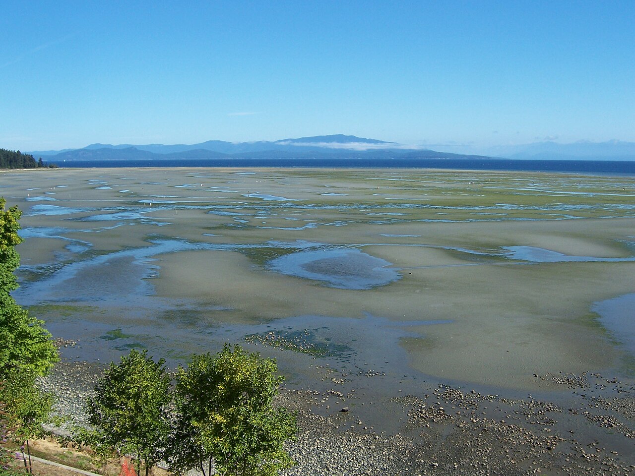
The shoreline changes character along the way. Ladysmith Harbour and Stuart Channel are sheltered by the Gulf Islands. Nanaimo's north-end points and Lantzville face the open Strait of Georgia over sandstone and rock. Nanoose Bay mixes quiet coves with exposed headlands, and from Parksville to Qualicum Beach the coast turns to long, low sandy beaches with wide tidal flats that continue, more quietly, through Qualicum Bay, Bowser and Deep Bay.
Exposure, bank height, beach type, moorage and road access set the value of a waterfront property as much as the house, and this page follows the shoreline community by community.
This page shows every listing flagged as waterfront: oceanfront houses and acreages, beachfront condos and townhomes, homes on lakes and rivers, and vacant waterfront lots. Oceanfront makes up most of it. Lakefront is limited to a few lakes, such as Long Lake in north Nanaimo and Quennell and Holden lakes in Yellow Point and Cedar, and riverfront comes mostly from the Nanaimo, Englishman, Little Qualicum and Chemainus rivers.
Not every home that looks at the water is on it. A road, a public walkway or a strip of Crown land between the lot and the beach changes what an owner can do at the shore, and in Qualicum Beach in particular, many homes with a wide ocean outlook sit across Highway 19A from the sand. Bank height also changes from one stretch to the next: walk-on, low-bank beaches dominate from Parksville to Deep Bay, rocky mid- and high-bank frontage is typical of north Nanaimo, Lantzville and the Nanoose peninsula, and sandstone shelves line the sheltered shores of Yellow Point, Gabriola and Ladysmith. Homes without frontage appear on the Nanaimo and Parksville view homes page rather than here, unless the listing also has frontage.
Nanaimo waterfront homes are concentrated in the north end. Around Departure Bay, houses face Newcastle Island across sheltered water, with a beach at the head of the bay and the ferries coming and going from the terminal. Farther north, Hammond Bay, Stephenson Point and Rocky Point sit on rocky, sandstone shoreline facing the open Strait, with long views to the Coast Mountains and the islands offshore; these points hold some of the most valuable homes in the city. Neck Point and Pipers Lagoon parks break up the private frontage and give the neighbourhood public shoreline to walk.
Closer to downtown, a few homes and condos front Newcastle Channel, and Protection Island, in the harbour, has homes reached only by boat or the small passenger ferry from downtown. South of the harbour, the Nanaimo River estuary and Duke Point have little residential waterfront. Inland, Long Lake in north Nanaimo is lined with lakefront homes within the city, a rare chance at freshwater frontage inside city limits.
Lantzville's waterfront runs along Lower Lantzville, where older beach cottages and new custom homes share the shore facing Nanoose and the islands of the Strait. Lots here are often deeper than in the city, and the setting suits buyers who want oceanfront close to Nanaimo without a city feel.
Nanoose Bay and Fairwinds Waterfront
Nanoose Bay waterfront is the most varied on this part of the coast. At Fairwinds and around the outer peninsula, homes sit on rocky headlands and small coves with open views across the Strait and the Schooner Cove marina nearby for moorage. This is one of the area's main luxury waterfront markets.
Inside the bay, the water is shallower and more sheltered, with tidal flats toward the head of the bay, a waterfront condo complex near the highway and older homes on gentler shoreline. Northwest Bay and the smaller neighbourhoods on the peninsula add a mix of both. Parts of the surrounding water belong to the naval test range operated by the Canadian Forces, so boaters should know the restricted areas before planning moorage.
Parksville and Qualicum Beach Waterfront
Parksville waterfront is defined by sand. From Parksville Bay and Community Park east toward Rathtrevor Beach, the shore is low and gently sloping, and at low tide the water recedes far across the flats, which is ideal for beach walking and children but means a boat needs a nearby harbour rather than a private dock. Waterfront here includes houses, beachfront condos and resort suites. The Englishman River estuary lies within the Parksville-Qualicum Beach Wildlife Management Area, established in 1993, and Brant geese gather along these beaches each spring.
West of town, French Creek and the regional district's Electoral Area G add low-bank beachfront homes between Parksville and Qualicum Beach, with a small-craft harbour at French Creek for moorage.
Qualicum Beach waterfront is more limited than its long beach suggests. Along the central waterfront, Highway 19A runs between the town and the beach, so true beachfront homes are found where the road moves inland. At the west end of town, the mouth of the Little Qualicum River sits in the Marshall-Stevenson Wildlife Sanctuary, and riverfront and estuary-side homes there come with environmental setbacks.
Qualicum Bay, Bowser and Deep Bay Waterfront
Beyond Qualicum Beach, beachfront homes and cottages line the water side of Highway 19A in Qualicum Bay, Bowser and Deep Bay. The beaches are low-bank, with the same wide tidal flats, and prices for oceanfront are often lower than in the towns, which draws second-home and retirement buyers.
Deep Bay has a sheltered harbour and looks across the south end of Baynes Sound toward Denman Island. Baynes Sound is one of BC's main shellfish-farming areas, so check the foreshore tenures in front of any property here. Near the mouth of the Big Qualicum River, the Qualicum First Nation's reserve borders part of the shore.
Cedar, Yellow Point and Gabriola Waterfront
South of Nanaimo, Cedar-by-the-Sea, Yellow Point and the shore toward Ladysmith face the Gulf Islands across Stuart Channel. The water is sheltered from the open Strait, and much of the shoreline is sandstone shelves and small coves, like the ledges at Roberts Memorial Provincial Park. Many waterfront properties here are acreages with wells and septic systems. Quennell Lake and Holden Lake add rural lakefront, and the Nanaimo River offers riverfront acreage in Cedar and Cassidy.
Gabriola Island has waterfront all the way around: sandstone shores near Descanso Bay and the Malaspina Galleries, sheltered bays and marinas at Silva Bay on the southeast side, and quieter coves elsewhere. Docks and moorage depend on both provincial approval and Gabriola's land use bylaw, and a waterfront well can draw in salt water if it is pumped too hard in a dry summer, so test water quality and flow before you buy. Larger island and rural parcels, with or without frontage, are on the acreages and land page for the area.
Ladysmith and Chemainus Waterfront
Ladysmith waterfront centres on Ladysmith Harbour, a long, sheltered inlet with the town's marina, Transfer Beach Park and Stz'uminus First Nation lands along its shores. Private waterfront is limited, so homes on the harbour and the outer shore toward Stuart Channel come up only occasionally, and a few townhomes near the marina also front the harbour.
Between Ladysmith and Chemainus, Saltair's shoreline faces Thetis Island across Stuart Channel, with waterfront homes on larger lots in the Cowichan Valley Regional District. Chemainus itself has homes and condos close to the town's waterfront and the Chemainus River estuary, with the ferry to Thetis and Penelakut islands leaving from the centre of town.
Buying Waterfront in Nanaimo and Parksville
The foreshore below the high-water mark is Crown land, so a private dock, buoy or boat ramp needs provincial authorization, and setbacks from the natural boundary limit where you can build or rebuild. Check bank stability and erosion history on the high-bank points of north Nanaimo, Lantzville and Nanoose, any flood construction level the local government sets for low-bank beaches in Parksville, Qualicum Beach and Bowser, and any shellfish or log-storage tenures in front of the lot. The Vancouver Island waterfront page covers these checks in detail, and the home buying guide sets out how a purchase works.
Nanaimo and Parksville Waterfront Buyer Note
Before buying waterfront here, confirm the legal boundary and whether a road or walkway separates the lot from the beach, the bank height and erosion history, flood and setback rules, any dock or moorage authorization, foreshore tenures nearby, well and septic capacity on rural and island lots, and recent sales on the same stretch of shore.
Use the listings and map at the top of this page to compare oceanfront, lakefront and riverfront properties from Chemainus to Deep Bay and on Gabriola Island, or go back to the Nanaimo and Parksville real estate page for all listings. Shoreline asking prices and market times are reported in the Nanaimo and Parksville Waterfront Market Report.





 All Properties
  Houses
  Condos
  Townhomes
  View Homes
  Luxury Homes
  Acreages & Land
  Pet-Friendly
  55+ Homes
  Manufactured
  Homes with Suites
  Market Report